Mexborough & Swinton Times, December, 9th, 1932
Hidden Beauty
Where Nature Is Regaining Ground
“Slaverin’ Main”
Wombwell District’s Brightside
A teacher at one of the evening schools in the Wombwell district recently asked a number of boys a few questions of topography. The result was disappointing.
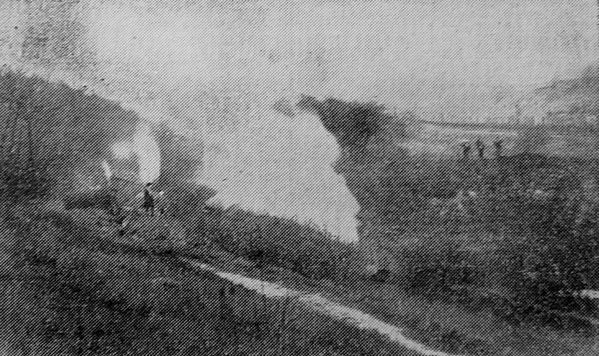
Actually they knew more about Central Africa and the Steppes of Russia than their own parish. But this lack of local knowledge is not confined to juveniles. Here is a picture of “Slaverin’ Main,” Dovecliffe.
Ask those who know the place what parish it is in, and nine out of ten will say, Worsborough. It is within the parish of Wombwell, though nearly two miles from Wombwell Town Hall. On the opposite bask of the Dove the parish of Worsborough extends to Aldham, nearly a mile nearer Wombwell.
Anyone studying local parish boundaries could do no better than chose “Slaverin Main” as a starting point. It marks the point where Wombwell touches Worsborough in the extreme corner of an angle, one arm of which is defined by a more or less arbitrary lino from Blacker Hill to the Dove, the other corner is the Dove itself. Going west to east, the parish boundary keeps to the water-course from Dovecliffe to Bolton Ings, a distance of three miles. The boundary line from that point into the south-west follows Knoll Beck through Wombwell Junction, Cortonwood and Tingle Bridge up to ‘ Jump. The parish is in the form of a rough triangle, the western section of which follows an irregular line from Jump to Dovecliffe, consisting in certain parts of nothing more than tumble-down stone walls. The boundary lino crosses Dovecliffe road some two hundred yards on the Wombwell side of Dovecliffe, and is marked by a perpendicular stone on the right hand.
It falls into the valley only a few yards on the Dovecliffe side of “Slaverin’ Main.”
“Slaverin’ Main” lies in one of the prettiest corners of Wombwell township. Years ago, before the coal trade developed, the neighbourhood was described as “the garden of Yorkshire,” and despite encroachment by canals and railways, by which it is hemmed in on three sides, the setting is still beautiful, particularly in the summer. There is an attractive walk from the village of Smithley, through “Convict Tunnel,” across open fields and along the Worsboro’ branch line to the viaduct of the railway, under which the path leads past “Slaverin’ Main” to Dovecliffe through a little thicket.
This corner of the township affords a fairly reliable index to local industrial development. First came the old coal units, of which “Slaverin’ Main” is typical, then was constructed the Dearne and Dove canal, next the Worsboro’ branch of the Great Central Railway, and as recently as 1895 was constructed the large viaduct which carries the L.M.S. railway from Wombwell Main to Barnsley. Winding through the valley is the tree-lined Dove. From the river bed there is a steep rise of 150 feet up a rocky promontory, rather striking in its rugged beauty, particularly against the setting sun.
Of the history of this old pitstead little is known, but it is quite likely that coal was worked there before Swaithe Main was sunk. Certainly it existed before the railway, which goes back eighty years. How it gained its peculiar name is also something of a mystery, but miners believe it arose from the “coughing and sneezing” of the drawing engines, which were of ancient type. From a day-hole in the cliff side the Melton Field seam was worked, and the coal was loaded into carts. The old mine is also known as “Wath Wood,” an alternative of “Melton Field.”
“Slaverin’ Main” was abandoned sixty or seventy years ago, and has since been used as a pumping station by the Wombwell Main Colliery Company. From this mine the seam runs up abruptly into Wombwell Wood. On the right of the road from the top of Smithley Lane to Dovecliffe Station is a large mound of earth which, on close inspection is revealed as the site of an old mine. This was known as the “Gin Pit.” From it the coal was drawn to work the winding gear when the shaft at Wombwell Main was put down a hundred years ago.
Mr. Mark Blackburn, of Hemiingfield, who is 85, told a “Times” representative that he had heard “old hands” say that the winding was worked by a horse running round a gin-race. He could remember when the shaft of the “Gin Pit” was enclosed by a wall, and he believes the shaft was filled in when a person accidentally fell down it.
The “Gin Pit” and “Slaverin’ Main” are connected by a culvert down which a clear stream trickles into a small reservoir. This water is said to possess two remarkable qualities; it never freezes, and it is regarded as a sovereign remedy for “had eyes.”
Mention of “Slaverin’ Main” recalls to mind an old custom unfailingly observed when the late Mr. Oxley was engine wright at Wombwell Main. For many years Mr. Oxley was one of the churchwardens at Wombwell, and once a year, at his invitation, the members of the Parish Church ‘ choir used to foregather at the old mine for a “wayzgoose.” Then was the cabin gaily decorated with flowers and greenery from the surrounding woods, and while the chops were sizzling on the fire-box in the cabin a runner would be dispatched to a tavern at Worsboro’ for liquid refreshment. That was in the time when the Rev. A. E. Hannan was incumbent and the parish had a “sporting” curate, the Rev. Wilmott Ware.